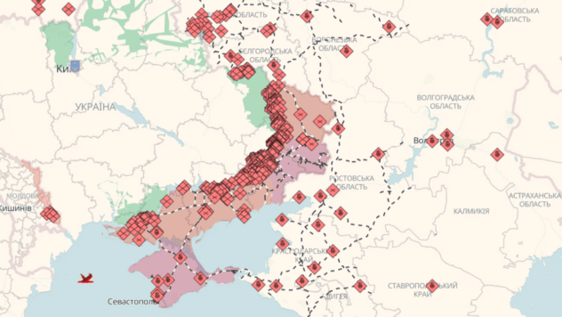
Interactive map of hostilities in Ukraine: where the fighting is happening

For more than a month of full-scale war in Ukraine, Russian troops have controlled only certain roads, not territories.
ICTV Facts offers maps of hostilities by Deep State, the Institute for the Study of War and CTP, which tentatively reflect the situation in Ukrainian cities.
Deep State map of hostilities in Ukraine online
Symbols on the map:
- Red areas are captured by Russian troops.
- Blue areas are territories from which Russian troops have been driven out.
Don’t use the map to make safe routes under any circumstances, but use the green corridors offered by the authorities.
Interactive map of hostilities in Ukraine
Symbols on the map:
Red dots – the latest developments
Gray dots – earlier events
On the right side is a panel where you can search by description.
Points – ground operations
Icon – air strikes
Map of hostilities in Ukraine since the beginning of Russia’s invasion of Ukraine by British intelligence
The full-scale war in Ukraine lasts from about 05.00 on February 24 by order of Russian President Vladimir Putin.
The invasion began with attacks on airfields, military depots in Kyiv, Kharkiv and Dnipro, as well as on the state border with Russia, Belarus and the occupied Crimea.
More information about the war in Ukraine – read online news in the material of ICTV Facts.


